Utah - Arizona 2007
Wire
Pass – Stateline Campground – The Wave
Not all trips go your way, but they
are all adventures.
We
planned a two-day side trip in the Vermillion Cliffs Wilderness
including Paria Canyon and Coyote Buttes area. We
hoped
to hike
through Wire Pass and up Buckskin Gulch, only far
enough to return the same day, spend the night in Stateline Campground,
and
hike to The Wave on the second day.
After
a good night’s sleep and a good breakfast
in Kanab, we
headed to the BLM Paria Contact Station on U.S. Hwy 89 for our permits
to The
Wave. The agent was very
reluctant to issue us a permit as there were
severe
thunderstorm warnings for the next couple of days creating the risk of
flash
flooding. After convincing him we were of sane minds and well prepared
for the
possibility of
being stranded for a short time (a
4-wheel
drive vehicle, shelter and plenty of food and water),
he issued us a permit with a few
pieces of
advice. Since you can’t tell if it is raining up top when you are in a
slot
canyon, listen for the thunder. Any sounds of thunder, no matter how
far away,
get out of the slot. It can be raining miles away and the natural
drainage is
through the slot canyons and creek beds.
We
headed back down Hwy 89 a short distance to
the House
Rock Valley Road, which separates the Cockscomb and the Buckskin
Mountain,
leading to and past the Buckskin Gulch Trailhead with one quick
traverse
through a creek bed (dry at this time, but it was obvious it could flow
pretty
good). We continued up road to the Wire Pass Trailhead which was on the
left
side of the road across from a small parking lot on the right with a
bathroom.
We decide to go ahead and get started on our day hike and find the
campground
later.
We
made sure to sign in at the register box.
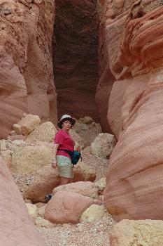
The entrance to
Wire Pass is just a short easy hike
down Coyote
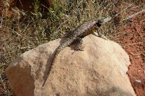
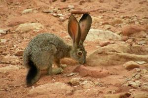
Wash, a dry creek bed which was very interesting on its own. We saw
plenty of
wildlife - two kinds of rabbits, a snake, and plenty of collared
lizards. At
one point we figured we were following some kind of large cat tracks.
After studying
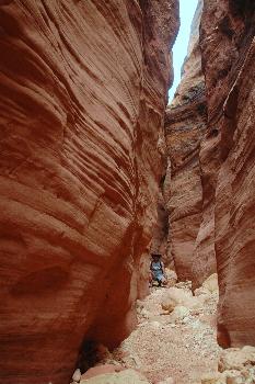
the fairly dark looking clouds, we decided to go ahead with the hike. Wire Pass
is an easy slot canyon with only a few scrambles. After about a
¼ mile in and
two short drops we were photographing a log jam above our heads. That’s
when we
heard the thunder. We immediately heeded the warning and turned around
and
headed out. After our first climb back up one of the scrambles, we
started to
feel drops of rain down in the slot. It was time to run. We pretty much
sprinted the rest of the way out and don’t even remember the second
scramble
except that we were pitching the camera equipment to one another. We
were
moving fast. Just as we exited, a trickle of water was making its way
down
Coyote Wash and into the slot. We sought higher ground as we continued
further
up the wash out of the slot and found a shallow opening high up in the
rocks
above the creek. We climbed up and took
shelter from the rain. While resting and having a snack, we saw grassy
bedding
and some small bones scattered around and figured that this was
probably the
dwelling of a big cat.
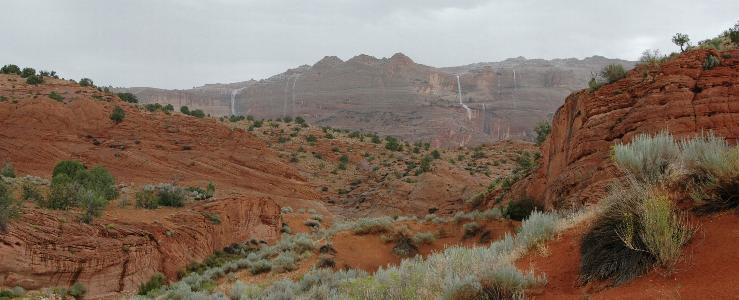
The
rain shower in our area was fairly light
but we could
see a major thunderstorm in the distance. Watching the thunderstorms
over a
distant butte created a “you had to be there” opportunity. We were
treated to a
vision of watching four very large waterfalls spill one-by-one over the
edge of
the cliff face. About that time the rain quit and, after a few quick
photos, we
took advantage of the break in the weather and headed back up Coyote
Wash to
the trailhead. On our trip out we never saw more than an inch of water
in the
creek. In these canyons, it is well
known that as little as ¼ inch of rain can run off the slick
rock and turn
these slots into an inescapable death trap.
Back
at the trailhead, we signed out, got in
the car and
headed further up House
Rock Valley Road to find Stateline
Campground. Very
quickly the road turned down into Coyote Wash and, at this point, it
was still
dry. A couple of hundred yards later, it turned back up out of the
wash. The
campground is not very far up the road and off to the right and another
trip
across the creek bed. This time we noticed the crossing was reinforced
with
steel mesh and grating.
After
picking a camp site, we ate lunch, took a
short nap
and pouted about not getting to hike.
But, because the sun came back out and everything was drying up,
we
decide to go back and at least try a short trip trough Wire Pass
to the junction of Buckskin Gulch and back. At least we could salvage
the
afternoon.
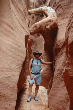
It
was only a short trip back to the entrance
of Wire Pass
and in we went. We quickly found out why it does not take much to flood
a slot
canyon. Immediately we could see changes in the rocks and loose debris
from
earlier rain. As we arrived at the first small drop there was a good
size pool
of water at the bottom. Although we figured it was not very deep, it
was the
first sign of the conditions of the rest of the hike through to
Buckskin Gulch.
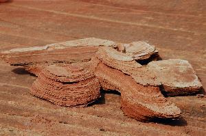
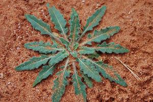
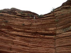
We decide to turn around and head back out. Still not wanting to give
up for
the day, we ventured over the rocks along the top of the slot. We were
able to
investigate some interesting rock formations and flowers and then
headed out
for the evening.
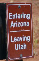
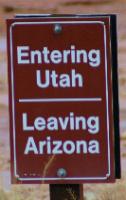 Back
at the campground, we explored the
surrounding trails and
paths. Wandering around the campground you pass in and out of two
states. Our
campsite was in Arizona, the restroom
was in Utah
and there are signs
everywhere telling you that you have crossed the state line. After we relaxed, had some dinner, met some
other hikers and exchanged stories, we settled down for the night.
Back
at the campground, we explored the
surrounding trails and
paths. Wandering around the campground you pass in and out of two
states. Our
campsite was in Arizona, the restroom
was in Utah
and there are signs
everywhere telling you that you have crossed the state line. After we relaxed, had some dinner, met some
other hikers and exchanged stories, we settled down for the night.
Although
the night started out well with a cool
light breeze
and almost a full moon, our adventure continued. Just minutes after
Patty
suggested we put the fly over the tent, just in case it rained, a storm
came
down upon us. We dug a trench around the tent to keep the water from
washing
under us. We spent the night enduring a monsoon in a 4x7 ft tent which,
at
times was being blown almost flat down on us.
The wind made it quite exciting at times and we could have slept
in the
car, but we probably would have lost the tent since our weight was
keeping it
from flying away.
The
morning brought some interesting decisions.
The weather
did not look much better and a quick look out over the terrain showed
us that Coyote
Wash was now running pretty fast. We had
come to see The Wave and this was the day for our permit. The permits
are not
easy to get. We checked with the other couple in the campground to see
what
they were going to do. We all decided to go ahead on the hike. We
packed up and
headed back to the trailhead. It was only a little over a mile and the
first
obstacle was to cross the creek just to get out of the campground. The second was the short drive in the creek
bed just before the trailhead. Both turned out to be no problem with
the four-wheel
drive.
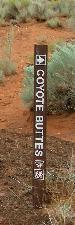
The
Coyote Buttes trail starts in the same
location as the
Wire Pass Trailhead. We signed in only a few minutes behind the other
couple
and hiked on in. About half way
to Wire Pass
the trail to Coyote Buttes and The Wave heads off to the right. The
first mile
or so was nice. The sky was overcast and the air was cool. As we
followed the cairns
and looked for our
landmarks, a light rain started. We decided to keep on going as we were
on top
of the terrain and less likely to risk a flash flood. Shortly after
climbing
the stair steps of Arizona
sandstone, the light rain very quickly turned into another monsoon. We
had
caught up to the other couple and discussed going on. Although we could
have
made it to The Wave, we would not be able to experience the views we
came to
see due to the rain. So again we turned around and headed back to the
trailhead.
Another
hiking day washed out (literally). We
were supposed
to spend another night at the campground before heading on to the south
rim of
the Grand Canyon for our anniversary
and a
hike to Phantom Ranch, but could not see a reason to stick around with
the
weather in the area. We made a quick decision to make the best of time.
Who
could pass up a trip to the north rim of the Grand
Canyon
as an alternate plan? The shortest distance to the North Rim was to
continue
south on House Rock
Valley Road
through Coyote
Valley and the
Vermillion Cliffs Wilderness
area. We didn’t know the condition of the road with the rain but we are
adventurous.
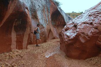
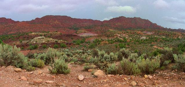
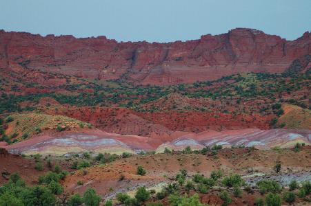
What
a treat the road turned out to be. The wet
ground
brought out all the colors in the terrain and rock faces. It looked
like
someone air brushed the colors during the night. It was another one of
those
“you had to be there at the right time” moments. The colors and the
flowers
made the rip to the North Rim spectacular.
Although,
we were washed out of both of our
intended hikes
we were treated to some fantastic sights due to the circumstances. We
will return
to these hikes in the future with better luck next time.
Mike
& Patty Poupart
(Date
of Trip: August 26-27, 2007)
 to Aggressive
Home
to Aggressive
Home
to Travels,
Hobbies & Interests