WHIRLWIND
TOUR THROUGH (SOME
OF) THE GRAND CIRCLE
– 2004
Although
the
“Grand Circle”
is defined as certain areas in the southwestern United States located
in
Arizona, Colorado, New Mexico, Nevada, and Utah, most of the “must see”
places
are located in northern Arizona and southern Utah.
At least that’s the ones we traveled to on
this trip. Unable to make their way out
west with us on previous trips, we took Mike’s sister, Shawn, and her
husband,
Donald, on a whirlwind tour of the southwest hitting some of the
highlights of
the Grand Circle.
Day One
–
Saturday,
August 28 – Getting There
The
adventure
began with a
flight to Las Vegas,
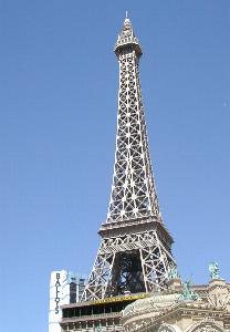
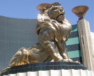
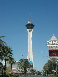
which is always a good jumping-off point. We took an exciting drive
down Las Vegas Boulevard
a/k/a “The Strip” to see all the icons and casinos seen on television
like the
pyramid at Luxor, the giant lion at MGM Grand, the Eiffel Tower of Paris, Paris, and the
Stratosphere. We then headed northeast
out of Las Vegas
on I-15. Wow! We
were cruising down the highway in the middle
of a desert landscape that soon gave way to towering rock formations
and
canyons.
While
traveling,
we’ve come
to use the interstate highway system as little as possible, usually
sticking to
state highways and sometimes dirt back roads that are not often
maintained. This is the only way to see America! You won’t see the “real world” as you fly by
on a super highway. You have to go find
the small towns that have existed off of state roads long before the
interstate
was ever built. You won’t regret it!
We also had
a
bit of fun and
confusion with the time zones. Nevada is in the Pacific zone, Utah
and Arizona are in the Mountain zone,
but Arizona
does not observe
daylight savings time. The Navajo
Reservation, which is in Arizona,
does observe daylight savings time. So,
as we moved from state to state in the Grand Circle, the time zones
continuously
changed, and we had to keep checking our clocks and our cell phones to
make
sure we had the right time so we wouldn’t be late for something
scheduled for a
particular time.
After
crossing
the
Nevada/Arizona state line and then the Arizona/Utah state line, it
wasn’t long
before we saw rock formations with vibrant colors showing the
geological layers
of time. After passing the town of St. George, UT,
we left
the interstate at exit 16 and continued driving east on UT-9 to the
town of Hurricane. We then turned onto east UT-59, traveling
more southeast, before the highway changes to AZ-389 at the
Utah/Arizona state
line. Wow! We’ve
crossed three state lines already! At the
town of Fredonia,
we turned southeast on US-89 to Jacob
Lake and then continued south
on AZ-67 a/k/a Grand Canyon Highway /
Kaibab Plateau-North Rim
Parkway.
Next
stop. .
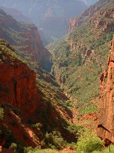
. Grand
Canyon’s North Rim
Once you
get on
AZ-67 coming
down from Jacob Lake
traveling into the Kaibab
National Forest,
you get
a sense of being somewhere very special.
The road is long and winds its way through the forest where
Aspens and
Ponderosa Pines seem to reach out to guide you along.
In the long, late afternoon shadows, deer and
other animals are out looking for food. Often
seen on the roadside and sometimes high above when the road is cut out
of the
side of a hill, they barely glanced as the cars passed by.
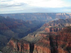
We finally came upon the national park
entrance station which makes little impact on this pristine wilderness.
We pulled
into
the parking
lot near the main lodge where there is a stone retaining wall in front
of a
sheltered bench facing the canyon. Looking past it through the trees
you could
see there was an open expanse just on the other side drawing you to
peer over
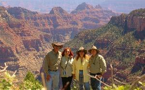
the edge until you gazed with awe at the canyon below.
The colors are amazing! We stepped
back to find another place to look
out and see a sign describing the beauty in front of us.
“Roaring Springs Canyon – Grand Canyon
--->” What?
This isn’t IT? Shawn and Donald
looked at us and we giggled. The same
thing happened to us the very first time we visited the Grand Canyon. We
assured them it
was more magnificent than this and continued down the narrow path to
the main
walkway out to Bright
Angel Point.
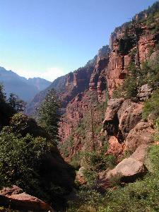
Although
the
walkway is
paved, it isn’t flat, and although the elevation changes are difficult
for some
people to negotiate, it is well worth the patience to take each uphill
section
slowly while resting and enjoying the views in between.
Usually it is the altitude that takes a
little getting used to. I once came upon
an older woman who was afraid of the narrow walkway with its steep
views down
off of either side. She was going to sit
on a rock and wait for her friends to enjoy Bright Angel
Point and re-group
with
them on their way back to the lodge. It
was breaking my heart that she would miss such a spectacular view. I convinced her to hold onto my arm and I
slowly walked with her the rest of the way until she was re-united with
her
party. She later found me and thanked me
for making her go because she had no idea what a truly wonderful sight
she
would have missed.
 As we
walked,
Shawn and
Donald kept getting peeks of the side canyons down on either side of
the path (Roaring Springs
Canyon on the left and Transcept Canyon on the right). The sun was getting low in the sky throwing
shadows all around. We got close enough
to the Point that you could see out towards Bright Angel Fault. I know my heart skipped a few beats, as it
always does when I peer into the canyon.
Shawn & Donald gasped and stood with jaws dropped in awe of
their
first sight of the Grand Canyon. Mike and I looked at each other and
smiled. Yeah, they’ll be hooked!
As we
walked,
Shawn and
Donald kept getting peeks of the side canyons down on either side of
the path (Roaring Springs
Canyon on the left and Transcept Canyon on the right). The sun was getting low in the sky throwing
shadows all around. We got close enough
to the Point that you could see out towards Bright Angel Fault. I know my heart skipped a few beats, as it
always does when I peer into the canyon.
Shawn & Donald gasped and stood with jaws dropped in awe of
their
first sight of the Grand Canyon. Mike and I looked at each other and
smiled. Yeah, they’ll be hooked!
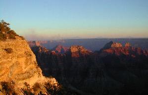
After
a few
photo attempts
at the moonrise, we headed back to the lodge in the last bit of
daylight for a
wonderful meal in the dining room to celebrate our fourth
wedding
anniversary. We tried to peer out into
the darkness through the floor to ceiling windows that make up 2 walls
of the
dining room. A short distance from the
dining room is an indoor observation room that opens onto an outdoor
patio with
a huge fireplace. Rocking chairs and
benches are placed near the stone walls for relaxing and enjoying the
views.
Day Two
–
Sunday, August
29 – Riding Mules on the North Rim
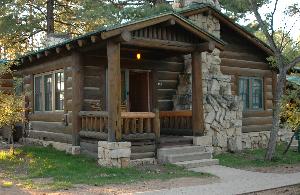
Our cabin
was
not far from
the lodge so we didn’t have a long walk to meet the shuttle bus to the
trailhead for our mule rides. Due to
closure of the lower part of the North Kaibab Trail for repair work,
our full
day ride to Roaring Springs was cancelled and we took two half-day
rides. First we took a 7:30 a.m. ride with a few
other people about halfway down
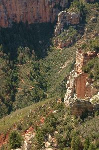
into the canyon on the North Kaibab Trail to Supai Tunnel.
This trip down the North Kaibab Trail was a
first for all of us and we were impressed at the views in Roaring Springs Canyon
as our surefooted
mules managed the steep switchbacks. We
dismounted at Supai Tunnel for a 15-20 minute break and hiked through
the
tunnel a short distance to see what was on the other side.
We returned
to
the rim for
lunch during a 45 minute break before the next ride.
The 12:30 p.m.
ride, led by an awesome female wrangler, took our little group
of four along the canyon rim through the forest on the Ken Patrick Trail
to Uncle Jim’s
Point. Upon reaching the end of the
trail, we dismounted and walked around a bit enjoying the expansive
views. We could also see the North Kaibab
Trail
where it continued below Supai Tunnel through Roaring Springs
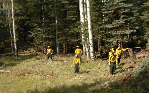
Canyon. There were prescribed fires burning at
various locations on the North Rim evidenced by the plumes of smoke we
saw
dotting the landscape in the distance.
We passed the firefighters going both ways.
They were clearing underbrush and making fire
breaks for an upcoming prescribed burn.
When horses or mules pass on a trail, protocol is for hikers or
trail
workers to stand still with arms down until the riders have passed so
as not to
“spook” the animals.
We
were
staying
a second
night on the North Rim and enjoyed another gorgeous sunset followed by
dinner
in the lodge and relaxing with a cup of coffee on our cabin porch. We were pretty pooped after a day of mule
rides, but anxious to see what the next day would bring.
Day
Three –
Monday,
August 30 – Cape
Royal and
Vermillion Cliffs
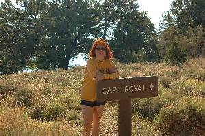
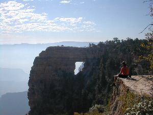
After
packing up
our gear
and having a hearty breakfast in the lodge, we drove over 20 miles on
the Cape
Royal Road on the Walhalla Plateau stopping at Cape Finial, Walhalla
Overlook,
the Walhalla Ruins and, finally, Cape Royal.
The morning views of Angel’s Window were awesome!
The smoke from the fires mixed with the
morning fog and hung thick in the canyon just below the rim making for
some
interesting photos.
From
Cape
Royal, the 60 mile drive back
to Jacob
Lake
finds our group pensive. We were leaving
a very special place, one that evokes thoughts and emotions about the
enormity of
the Grand Canyon and how we are so small in comparison to it and but a
microscopic spec in the whole of the universe that we exist in.
Traveling
east
on US-89 out
of Jacob Lake through the Kaibab Plateau, the highway suddenly emerges
at the
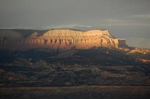
edge of the plateau over the valley floor overlooking Vermillion Cliffs. What a breathtaking site!
It’s not always about the destination; it’s
the journey that counts.
 Next
stop. .
. Marble
Canyon and Lee’s Ferry
Next
stop. .
. Marble
Canyon and Lee’s Ferry
As
we continued east on US-89A,
we stopped
at a roadside stand selling Indian gifts and jewelry in Marble Canyon. We
browsed and bought a few trinkets and took
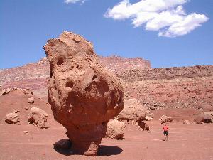
photos of the strange boulders and rock formations.
We cross the Colorado River on the Navajo
Bridge
near Lee’s Ferry at the top edge of the northernmost boundary of Grand Canyon National Park.
Lee’s Ferry is at river mile 0 of the Grand
Canyon on the Colorado River. When the highway merged back with US-89, it
turned north towards Page, AZ.
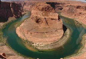
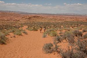
Next stop. . . Horseshoe Bend
There
is a place that a
Navajo guide told us about on a previous trip called Horseshoe Bend. This was a place we were anxious to share
with our family. We found it leaving
Page, AZ and now had to find it coming from the opposite direction. We were looking for a dirt parking lot off
the side of US-89 with large power lines crossing overhead. We parked the car, grabbed cameras and water,
and hiked up and over the sandy hill heading straight out into the
desert. After about 3/4 of a mile
following a faint
trail, we suddenly found ourselves on the edge of a high cliff
overlooking Horseshoe
Bend in the Colorado River. We were high above the river as it wound
around a huge monolithic plateau. The
emerald
green water was so clear in places that we could see the sandy bottom
of the
river. The area beneath us was so large
that we couldn’t fit it in the camera’s viewfinder even with a wide
angle lens!
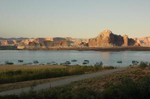
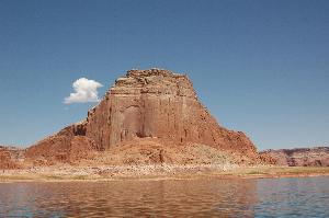
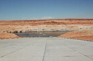
Next stop. . . Glen
Canyon Dam and Lake Powell
Just
outside of the town
limits of Page, AZ is Lake
Powell and the
Glen
Canyon Dam. This begins the Glen Canyon
National Recreation Area. We stopped at
the dam buildings for a short tour and to view the exhibits. The views of Lake Powell
as we drove Lakeshore
Drive
on the way to Wahweap were beautiful. We
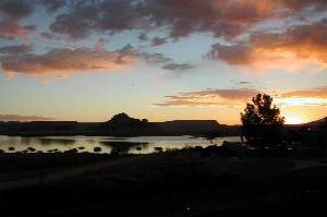
would be spending a couple days at Wahweap, the Lake Powell Resort. Our room overlooked the lake and we saw
beautiful sunsets and sunrises from our balcony. We
did a little bit of shopping at a nearby
grocery to get some snacks and lunch food for the big day on the water
we planned
for the following day.
Day 4 -
Tuesday,
August 31 - Spending
the Day on Lake
Powell
We
got up early, put on our
swim suits, packed our lunches and plenty of sunscreen ‘cause we were
spending
the day boating on Lake
Powell. We rented an 18’ power boat for cruising
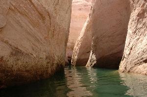
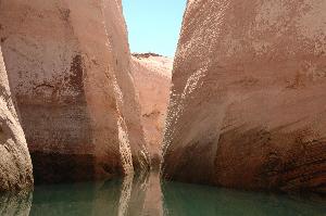
around in the lake and exploring slot canyons.
We learned that some of them have ancient Indian petroglyphs on
the
walls over your head as you motor along in the boat, but because the
water
level was so low, most of the petroglyphs would be over 100 feet above
our
heads. The biggest instruction we got
before leaving the dock was, “Don’t hurt the prop!”
There was an extra charge of $500 if anything
happened to the propeller, so we were cautioned to be very careful in
the
shallow areas. There was no water in the
cut across Castle Rock, so we had to go the long way around through the
channel. Some of the canyons we ducked
in and out of included Cathedral
Canyon, West
Canyon, Antelope
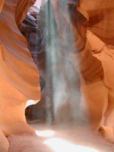
Canyon, and Navajo Canyon.
It was suggested that we go to Rainbow Bridge National
Monument,
but we didn’t have enough time with all the other exploring. Guess that’ll be a future trip!
I can’t talk about this
wonderful day we spent on Lake
Powell without
telling
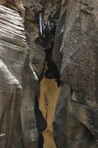
about one of the slot canyons we stopped to explore.
We were coming in slow and tight and reaching
out with our hands and the oars to keep the boat off of the walls of
the canyon
which was as wide as the boat at this point as edged the front of the
boat in
he sand at the end of the slot. The wet
sand looked and felt pretty solid as we came to a stop.
Shawn was at the front of the boat and
volunteered to jump off with the rope and find something to tie us off
to. When her feet hit the sand, she sunk
to her
knees! Her eyes and her mouth were WIDE open and she was gasping with
surprise! Luckily, she was able to pull
her legs out
and still had her tennis shoes on. We
hiked a short way up the slot and scrambled up a tree limb that was
propped
against the boulders. There was a little
water flowing down it to make it interesting and a little slippery. We hiked a little further and made another
small scramble up to a very sandy area but couldn’t go any further.
Next
stop. . . Grand Staircase Escalante
From
Page, AZ, we headed west-northwest on US-89, crossed the Colorado River
again
at Glen Canyon Dam, and then crossed the border into Utah through the
bottom
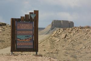
part of Grand Staircase-Escalante National Monument.
In
the remote and beautiful Kaiparowits
Plateau of
southern Utah,
we stopped at the new Bureau of Land Management Visitor Center in Big
Water. The center has a Late Cretaceous
paleontology
theme. The real highlight of the visit
was meeting Dr. Alan Titus, BLM paleontologist, who was proud to show
off the fossils
of the Monument’s duckbilled dinosaur, a crested hadrosaur (Parasaurolophus) that
were on display. He also told us of a
recent
dinosaur find that he was a part of, that of a non-crested hadrosaur
genus, Gryposaurus.
The skeleton had recently been finished and transported to the Big Water Visitor
Center
for exhibition. Dr. Titus mentioned a
new discovery of the complete skulls of two Gryposaurus-like hadrosaurs
that were
found within the Monument the previous year in 2003. Those fossils were
being
collected by scientists during that summer of 2004.
Past
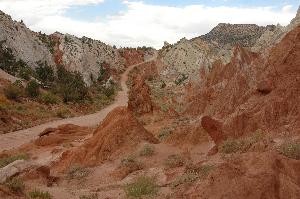
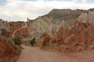
the town of Big Water,
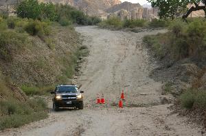
we detoured onto Cottonwood
Canyon Road, a dirt road also known as the
Cottonwood
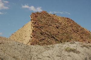
Canyon Scenic Backway, and headed north towards Cannonville. The landscape was bright and colorful and the
road followed alongside of the bottom edge of the uplift known as The
Cockscomb. It was interesting to see the
uplift with the
topsoil leaning on its side. Even though
we had a 4-wheel drive vehicle, we did have to make a few careful
detours so as not to get stuck in a hole or a giant mud puddle.
A
caution to the reader: Bypassing main roadways for dirt roads is not
recommended unless you are in a 4-wheel drive or all-wheel drive
vehicle as
some roads are not routinely maintained.
In case of rain, roads can become impassable and the possibility
is high
for a flash flood. The dirt road you are
on or dry creek bed you are in could quickly become a fast flowing
river. You could be stuck for quite a
while, perhaps
several days, before anyone comes along to help. Always
have sufficient food and water to
sustain you in case of such an emergency.
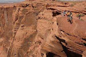
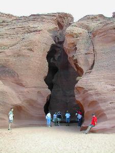
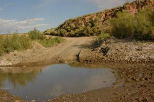
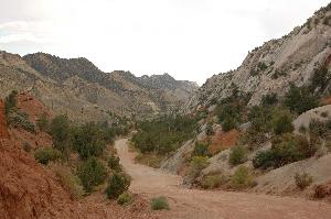
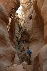
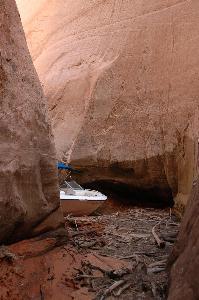
We
found a trailhead and stopped to hike for a short time through the
Navajo
sandstone in the Cottonwood
Canyon Narrows. We
were aware of clouds gathering overhead, a
sure sign that it could be raining anywhere in the area creating the
possibility for a flash flood, so we decided to cut the hike short and
continue
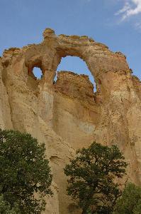
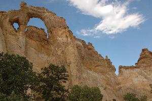
on to Grosvenor Arch. We came upon a tall
formation of isolated yellowish-gold sandstone reaching hundreds of
feet into
the air with not one, but two arches.
Donald and I jumped out with our cameras and photographed it
from many
different angles. There was a picnic
area here as well, but it was swarming with bees that chased us back
into the
SUV.
Next
stop. . . Kodachrome
Basin State
Park
We
got back onto Cottonwood
Canyon Road which bends and twists crossing
steep ridges
on the way to Kodachrome
Basin State
Park. A
modest day-use fee is required to be paid at the self-service fee
station. We drove through the campground
area which is
located about a half mile from the trailhead along the loop at the end
of the
road. There are also a half-dozen cabins
for rent as well as a general store. There
are six hiking trails in the park, most of them less than a mile,
except for
the Panorama Trial, which is a loop trail almost 3 miles long and the
Big Bear
Geyser Trail that is about 2.5 miles long.
 There
are lots of different landforms in the park, but the most unusual are
the sand
pipes, believed to have once been part of a geothermal area with hot springs and
geysers. The white, chimney-like spires
are composed of coarse sand and average 30-50 feet in height. Scientists believe that after the springs and
geysers ceased to flow, they filled with sand, and created the white
spires
seen today.
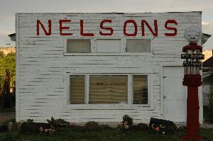
Turning
out of Kodachrome, we were back on a paved road and soon at the
junction of
Cottonwood Canyon Road and UT-12, which runs southwest from Escalante
to
Henrieville, Cannonville, Tropic and on through Bryce Canyon before
meeting up
with US-89. We saw a neat old gas
station/garage called “Nelsons” in Cannonville that was interesting
enough for
a photo
opp. The old gas pump out front has a sign that
reads, "Too pooped to pump."
There
are lots of different landforms in the park, but the most unusual are
the sand
pipes, believed to have once been part of a geothermal area with hot springs and
geysers. The white, chimney-like spires
are composed of coarse sand and average 30-50 feet in height. Scientists believe that after the springs and
geysers ceased to flow, they filled with sand, and created the white
spires
seen today.
Turning
out of Kodachrome, we were back on a paved road and soon at the
junction of
Cottonwood Canyon Road and UT-12, which runs southwest from Escalante
to
Henrieville, Cannonville, Tropic and on through Bryce Canyon before
meeting up
with US-89. We saw a neat old gas
station/garage called “Nelsons” in Cannonville that was interesting
enough for
a photo
opp. The old gas pump out front has a sign that
reads, "Too pooped to pump."
Next stop. . . Bryce
Canyon National
Park
We
entered Bryce
Canyon
National Park at
the northeast
corner and continued on a very scenic drive until we reached the lodge
where
there is access to the rim trail and overlooks of the amphitheater. It was getting dark as we arrived and not
much of the canyon could be seen. We
arrived a day earlier than originally anticipated.
Luckily, we were able to get a room at one of
rustic-looking hotels a short distance away from the cabins and main
lodge.
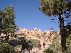
Day
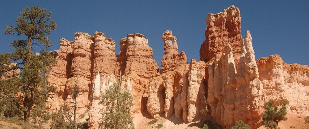
6 – Thursday, September 2 - Riding Horses in Bryce Canyon
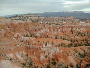
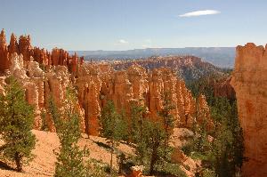
Bryce is famous for its
worldly unique geology, consisting of a series of horseshoe-shaped
amphitheaters carved from the eastern edge of the Paunsaugunt Plateau
in
southern Utah.
Erosion and rain have shaped the colorful limestone rock of the Claron
Formation into bizarre shapes including slot canyons, windows, fins,
and spires
called "hoodoos." These whimsically arranged rocks create a wondrous
landscape of mazes and trails.
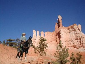
We
started our day at Bryce
Canyon with a nice
breakfast in the lodge dining room followed by a half-day mule ride on
the
trails down through the canyon. The
wranglers are from Canyon Trail Rides out of Tropic Utah and are among
the best
we’ve ridden with so far. The best way to see Bryce is to get down into
the
canyon and be among the trees and tall spires, looking up into the
windows
eroded from the rock.
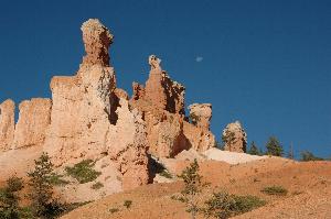
The sky is what
continues to
amaze me in this part of the country. It is such a deep shade of azure
blue and
makes a fantastic backdrop to the spires and rock formations. We had a great morning ride and spent the rest
of the day moving around on the rim from lookout to lookout taking
photos. We saw lots of deer moving around
the park
and tried to get photos of a doe that was being very protective with a
couple
of fawns. Even in the fading light of
day, the views of the hoodoos were worth every minute we could spend
looking
out into the canyon. We watched an
awesome sunset over the Aquarius Plateau in the distance.
We
moved from the hotel and settled into the western-style cabin we
originally
reserved. It was a short walk over to
the main lodge for a very satisfying dinner.
Later, as the darkness of the night fell upon the landscape, we
walked from
our cabin to the rim of the canyon using flashlights to light our way. Blackness was all around us as we turned our
faces towards the sky to see the most magnificent display of stars that
the
heavens could offer. We wanted to lie in
the grass and stare at them all night!
Day 7 -
Friday,
September 3 – Bull Valley
Gorge
We left Bryce after breakfast
heading southeast on UT-12 back towards Cannonville.
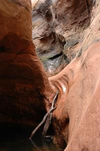
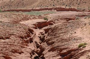
Turning off of UT-12 and following signage
for Johnson
Canyon, we found
ourselves traveling due
south on Skutumpah Road,
another dirt road which crosses a large area of wooded hills and
valleys. We crossed a small bridge and,
looking over,
saw a big crack in the ground. Was that
a slot canyon? We found a place to park
nearby so we could walk around to explore this intriguing slot canyon
which we later
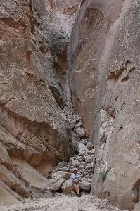
learned was Bull Valley Gorge. We learned
the story about the wreck of the 1950s pick-up truck,
wedged high above a section of narrows which now forms the base of the
one road
bridge across the canyon, the one we just crossed.
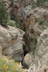
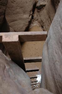
The
slot looked pretty deep from the top. We
walked through a gate by the bridge and
followed a path for about a half mile along the top before we got to
the end
where it was shallow and were able to find a place to climb in, turn
back and
start hiking back in the direction from which we came.
We were stoked! This slot was so
cool! It got deep quickly and we were
climbing up and
over boulders and debris from a recent flash flood until we got to a
big
drop. We stood on the edge looking down
the rungs of a homemade wooden ladder, the bottom of which was in a
pool of
water. Hmmm… How far down do you think
that is? How deep is that pool? We dropped a big rock into it and it sunk
with a deep sound and very little splash.
Between that and not trusting the ladder, we opted to turn
around and go
back. We were unprepared for a real hike
into a slot canyon. We didn’t have any ropes or proper equipment in
case we
were to get in there and not have a way back out. We
didn’t even bring a bottle of water with
us, just the cameras – you know, the important stuff!
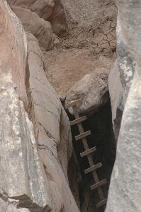
After
we scrambled our way back out of the gorge, we walked
back along the top heading back to the car.
We did get a view of the truck wedged in the rocks under the
bridge and
got a few good photos. We also found the
area of the gorge where we stopped hiking and walked a bit further to
get a
different look at it. Our stomachs did a
flop when we saw that where we had been standing contemplating the
ladder and
the pool of water was nothing more than a large boulder wedged in a
crack, a small
chock stone holding a larger one in place, with about a 10 ft. dry fall
drop. Holy smoke! Good
thing the stone didn’t give way!
Next stop. . . Zion
National Park
From
Skutumpah Road,
we came to
another dirt
road where we turned right and got on Glendale Bench Road / Johnson Canyon Road
heading west to US-89
where we went through Orderville, turned left and traveled south to
UT-9, the Mt.
Carmel Junction. From there we headed
west on UT-9 to Zion
National Park. Zion
is a gorgeous place like none we have ever seen! Not
too far inside the East Entrance is
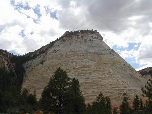
Checkerboard Mesa, so named because of the squares cut into the face of
the
cliff face by wind and rain. The drive
on Zion-Mt. Carmel Scenic Byway (through a tunnel) is breathtaking! A park shuttle is available to take
passengers to the various stops on Zion Canyon Scenic Drive, which
is closed to private
vehicles. There are many trails for
short hikes and nature walks as well as steep climbs and long loop
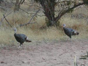
hikes. Wildlife is abundant here! The deer, squirrels and even wild turkeys
practically come right up to you!
Since
it was getting late in the afternoon, we drove through the park to see
a few of
the popular sites before exiting at the South Entrance to check into
our rooms
at Flannigan’s Inn, located in Springdale, UT just outside the southern
entrance of the park. Mike and I have
stayed
here before and enjoy the amenities offered by the Inn,
including the Spotted Dog Café, a fine dining restaurant. Since the first time Mike & I stayed
there,
a day spa has been added. One day we’ll
have to schedule some time to enjoy it.
Day 8 - Saturday,
September 4 – Hiking the Narrows
After
a good breakfast at the Bumbleberry Inn in Springdale,
we went over to the Zion Adventure Company to get fitted for water
shoes and
walking sticks that we rented for hiking in the Narrows. This was the only hike we had actually
planned and prepared for and was the most strenuous hike during the
entire trip. We boarded a shuttle bus
across the street
from the Inn that took us to the
South
Entrance of the park. We walked in
through the entrance station and boarded the Zion Canyon Scenic Drive shuttle
that
took us to the Temple
of Sinawava, the
last and
northernmost shuttle stop. The 1 mile
paved
Riverside Trail leading to the Gateway to the Narrows
meandered along with the river on the left and cliff walls on the right. In many places, the walls were seeping water
creating a lush environment for growing ferns and flowering vines. It’s a beautiful walk even if you didn’t plan
to hike any further than the edge of the river.
At the end of the paved path, we took turns posing for a few
photos
before stepping into the cool waters of the Virgin
River.
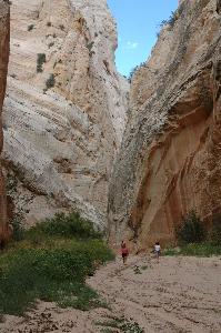
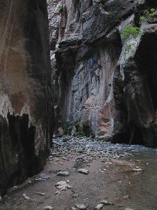
The
Virgin River has carved a spectacular gorge in the upper reaches of Zion Canyon
that is 16 miles long, at times only 20 feet wide, with the canyon
walls towering
up to 2000 feet high. Walking in the
shadow of the soaring walls, sandstone grottos, natural springs, and
hanging
gardens of the Zion
Narrows is another
of our
previous unforgettable wilderness experiences that we were anxious to
share
with our family.
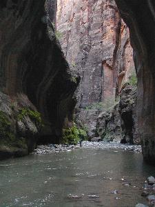
The
Narrows is a hike with about 60% of the hike in the river and 40% on
the shore
following rocks and sandbars and small beaches.
You follow the winding path the river has carved over millions
of years
picking your way among the rocks and sometimes wading when the water is
wall-to-wall in the canyon. The walking
sticks and water shoes are “must-haves” for hiking in the water. Because the rocks under the water gather
algae, it’s like walking on slippery bowling balls.
This
is a very scenic hike in spite of having to pay attention to where you
are
stepping. It is worth it to take the
time to stop and admire the waterfalls, explore secret alcoves, and
enjoy the
deep pools of water.
Our
hike began where the water was pretty shallow at first and the walls
towered
above us on either side. The depth of
the water grew deeper as we hiked further in.
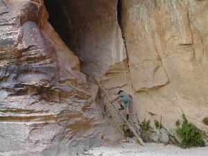
At one point, it was between my knees and mid-thigh. Mike saw a tree trunk leaning against a
cave-like opening in the canyon wall. He
climbed the 15 ft. length and disappeared into the cave. Other
hikers stopped with us and cheered for
him. A few minutes later, he came out
shrugging his shoulders saying that it didn’t go anywhere.
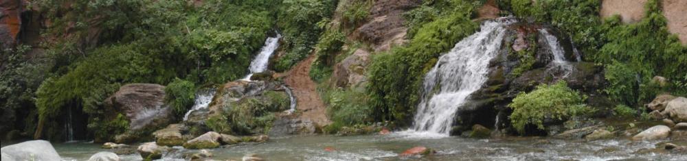
We
got to Orderville
Canyon and hiked a
little
way up before turning around and returning to the main river to
continue our
hike. It was about a 3.5 mile hike to Big
Springs, which was the end of the line for us.
It was lush and green with several waterfalls.
We took time to enjoy the water and eat our
lunch there before heading back. The
shadows were getting long by the time we went back through Wall Street,
where
the canyon walls tower at almost 2000 feet overhead.
This
was an all-day slightly strenuous hike and we were pretty exhausted. We
spent a second night at Flannigan’s Inn
and
crashed pretty hard after dinner.
Day 9 - Sunday,
September 5 - Home Sweet Home!
Some of us were nursing sore
muscles from yesterday’s hike, but we were no less enthusiastic about
how we
spent the last 8 days. The last leg of
our adventure was simply to drive back to the airport in Las Vegas.
From Springdale, we drove west
on UT-9
until we joined I-15 heading south to Las Vegas.
The ability to share our
experiences in such beautiful places with our family and friends is
important
to us. Shawn and Donald have been
successfully hooked on the southwest and are already talking about a
return
trip. For now, our annual whirlwind
through the southwest was over and it was time for us to go back home
to flat
land, muddy bayous, and almost-blue skies.
South Louisiana is a beautiful place, but so very different from
the Southwestern United States. God Bless America!
Mike and
Patty Poupart
(Date of
Trip: August 28,
2004 - September
5, 2004)
Helpful
Links:
Antelope Canyon - http://www.navajonationparks.org/htm/antelopecanyon.htm
Bryce Canyon
National Park – http://www.nps.gov/brca/index.htm
Glen Canyon National Recreation Area - http://www.nps.gov/glca/
Grand Canyon National Park – http://www.nps.gov/grca/
Grand
Circle – http://www.grandcircle.org/
Grand Staircase-Escalante
National Monument - http://www.blm.gov/ut/st/en/fo/grand_staircase-escalante.html
Kodachrome Basin
State Park - http://www.utah.com/stateparks/kodachrome.htm
Vermillion
Cliffs - http://www.blm.gov/az/st/en/prog/blm_special_areas/natmon/vermilion.html
Zion National Park – http://www.nps.gov/zion/
 to Aggressive
Home
to Aggressive
Home
to Travels,
Hobbies & Interests